Calls the 3DHP_all web service and returns sf data.frames for the selected layers. See https://3dhp.nationalmap.gov/arcgis/rest/services/usgs_3dhp_all/FeatureServer for source data documentation.
get_3dhp(
  AOI = NULL,
  ids = NULL,
  type = NULL,
  universalreferenceid = NULL,
  t_srs = NULL,
  buffer = 0.5,
  page_size = 2000
)
Arguments
- AOI
sf (MULTI)POINT or (MULTI)POLYGON. An 'area of interest' can be provided as either a location (sf POINT) or area (sf POLYGON) in any Spatial Reference System.
- ids
character vector of id3dhp ids, mainstem uris, or workunitid prefixed ids (e.g. "workunitid:300585")
- type
character. Type of feature to return. e.g. ("hydrolocation", "flowline", "waterbody", "drainage area", "catchment"). If NULL (default) a data.frame of available types is returned
- universalreferenceid
character vector of hydrolocation universal reference ids such as reachcodes
- t_srs
character (PROJ string or EPSG code) or numeric (EPSG code). A user specified - target -Spatial Reference System (SRS/CRS) for returned objects. Will default to the CRS of the input AOI if provided, and to 4326 for ID requests.
- buffer
numeric. The amount (in meters) to buffer a POINT AOI by for an extended search. Default = 0.5
- page_size
numeric default number of features to request at a time. Reducing may help if 500 errors are experienced.
Value
a simple features (sf) object or valid types if no type supplied
Details
The returned object(s) will have the same
Spatial Reference System (SRS) as the input AOI. If a individual or set of
IDs are used to query, then the default CRS of EPSG:4269 is
preserved. In all cases, a user-defined SRS can be passed to t_srs
which will override all previous SRS (either input or default).
All buffer and distance operations are handled internally using in
EPSG:5070 Albers Equal Area projection
Examples
# \donttest{
AOI <- sf::st_as_sfc(sf::st_bbox(c(xmin = -89.56684, ymin = 42.99816,
xmax = -89.24681, ymax = 43.17192),
crs = "+proj=longlat +datum=WGS84 +no_defs"))
# get flowlines and hydrolocations
flowlines <- get_3dhp(AOI = AOI, type = "flowline")
#> GET https://3dhp.nationalmap.gov/arcgis/rest/services/usgs_3dhp_all/FeatureServer/?f=json
#> POST https://3dhp.nationalmap.gov/arcgis/rest/services/usgs_3dhp_all/FeatureServer/50/query
#> POST https://3dhp.nationalmap.gov/arcgis/rest/services/usgs_3dhp_all/FeatureServer/50/query
hydrolocation <- get_3dhp(AOI = AOI, type = "hydrolocation")
#> POST https://3dhp.nationalmap.gov/arcgis/rest/services/usgs_3dhp_all/FeatureServer/20/query
#> Warning: No hydrolocation - sink, spring, waterbody outlet features found in area of interest.
#> POST https://3dhp.nationalmap.gov/arcgis/rest/services/usgs_3dhp_all/FeatureServer/30/query
#> Warning: No hydrolocation - headwater, terminus, divergence, confluence, catchment outlet features found in area of interest.
#> POST https://3dhp.nationalmap.gov/arcgis/rest/services/usgs_3dhp_all/FeatureServer/40/query
#> POST https://3dhp.nationalmap.gov/arcgis/rest/services/usgs_3dhp_all/FeatureServer/40/query
waterbody <- get_3dhp(AOI = AOI, type = "waterbody")
#> POST https://3dhp.nationalmap.gov/arcgis/rest/services/usgs_3dhp_all/FeatureServer/60/query
#> POST https://3dhp.nationalmap.gov/arcgis/rest/services/usgs_3dhp_all/FeatureServer/60/query
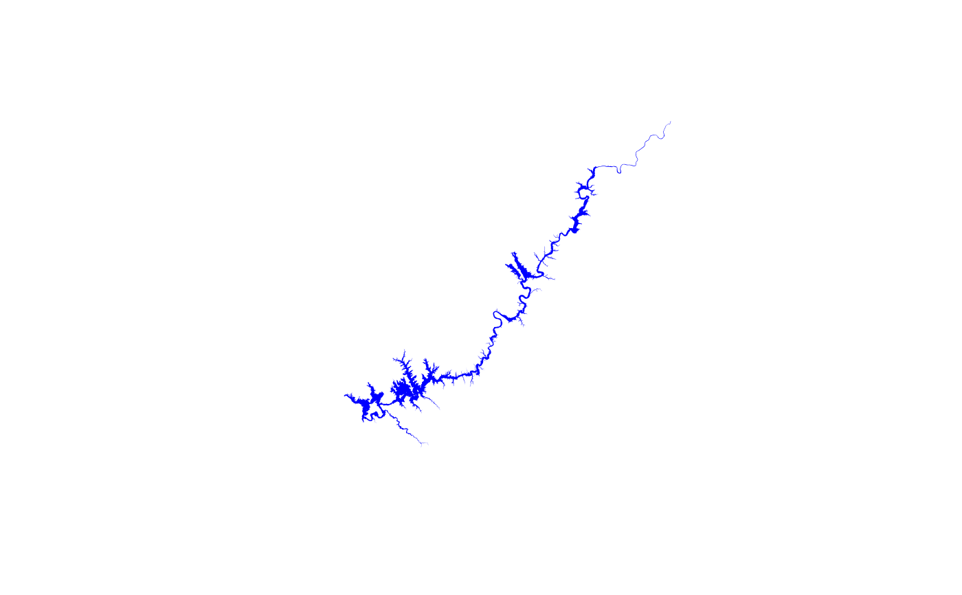
if(!is.null(waterbody) & !is.null(flowlines) & !is.null(hydrolocation)) {
plot(sf::st_geometry(waterbody), col = "lightblue", border = "lightgrey")
plot(sf::st_geometry(flowlines), col = "blue", add = TRUE)
plot(sf::st_geometry(hydrolocation), col = "grey", pch = "+", add = TRUE) }
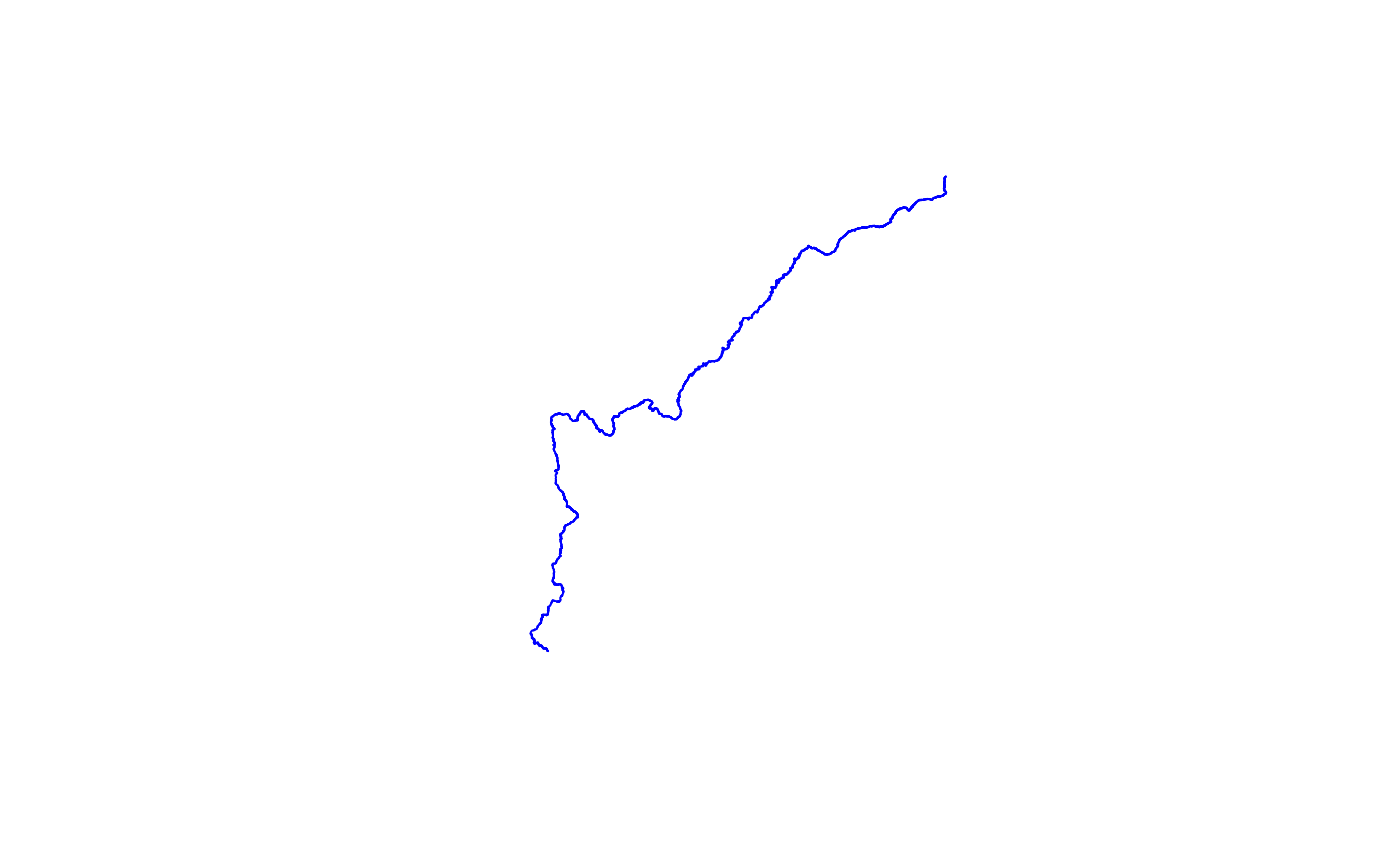
 # given mainstem ids from any source, can query for them in ids.
SU <- get_3dhp(ids = "https://geoconnex.us/ref/mainstems/194408",
type = "flowline")
#> POST https://3dhp.nationalmap.gov/arcgis/rest/services/usgs_3dhp_all/FeatureServer/50/query
#> POST https://3dhp.nationalmap.gov/arcgis/rest/services/usgs_3dhp_all/FeatureServer/50/query
if(!is.null(SU))
plot(sf::st_geometry(SU), col = "blue")
# given mainstem ids from any source, can query for them in ids.
SU <- get_3dhp(ids = "https://geoconnex.us/ref/mainstems/194408",
type = "flowline")
#> POST https://3dhp.nationalmap.gov/arcgis/rest/services/usgs_3dhp_all/FeatureServer/50/query
#> POST https://3dhp.nationalmap.gov/arcgis/rest/services/usgs_3dhp_all/FeatureServer/50/query
if(!is.null(SU))
plot(sf::st_geometry(SU), col = "blue")
 # get all the waterbodies along the Susquehanna river
SU_wb <- get_3dhp(ids = unique(SU$waterbodyid3dhp), type = "waterbody")
#> POST https://3dhp.nationalmap.gov/arcgis/rest/services/usgs_3dhp_all/FeatureServer/60/query
#> POST https://3dhp.nationalmap.gov/arcgis/rest/services/usgs_3dhp_all/FeatureServer/60/query
if(!is.null(SU_wb)) {
plot(sf::st_geometry(SU_wb[grepl("Otsego", SU_wb$gnisidlabel),]),
col = "blue", border = "NA") }
# get all the waterbodies along the Susquehanna river
SU_wb <- get_3dhp(ids = unique(SU$waterbodyid3dhp), type = "waterbody")
#> POST https://3dhp.nationalmap.gov/arcgis/rest/services/usgs_3dhp_all/FeatureServer/60/query
#> POST https://3dhp.nationalmap.gov/arcgis/rest/services/usgs_3dhp_all/FeatureServer/60/query
if(!is.null(SU_wb)) {
plot(sf::st_geometry(SU_wb[grepl("Otsego", SU_wb$gnisidlabel),]),
col = "blue", border = "NA") }
 # given a workunitid, can query for features in that work unit
wufl <- get_3dhp(ids = "workunitid:300585", type = "flowline")
#> POST https://3dhp.nationalmap.gov/arcgis/rest/services/usgs_3dhp_all/FeatureServer/50/query
#> Getting features 0 to 2000 of 14676
#> POST https://3dhp.nationalmap.gov/arcgis/rest/services/usgs_3dhp_all/FeatureServer/50/query
#> Getting features 2000 to 4000 of 14676
#> POST https://3dhp.nationalmap.gov/arcgis/rest/services/usgs_3dhp_all/FeatureServer/50/query
#> Getting features 4000 to 6000 of 14676
#> POST https://3dhp.nationalmap.gov/arcgis/rest/services/usgs_3dhp_all/FeatureServer/50/query
#> Getting features 6000 to 8000 of 14676
#> POST https://3dhp.nationalmap.gov/arcgis/rest/services/usgs_3dhp_all/FeatureServer/50/query
#> Getting features 8000 to 10000 of 14676
#> POST https://3dhp.nationalmap.gov/arcgis/rest/services/usgs_3dhp_all/FeatureServer/50/query
#> Getting features 10000 to 12000 of 14676
#> POST https://3dhp.nationalmap.gov/arcgis/rest/services/usgs_3dhp_all/FeatureServer/50/query
#> Getting features 12000 to 14000 of 14676
#> POST https://3dhp.nationalmap.gov/arcgis/rest/services/usgs_3dhp_all/FeatureServer/50/query
#> Getting features 14000 to 14676 of 14676
#> POST https://3dhp.nationalmap.gov/arcgis/rest/services/usgs_3dhp_all/FeatureServer/50/query
# given universalreferenceid (reachcodes), can query for them but only
# for hydrolocations. This is useful for looking up mainstem ids.
if(!is.null(hydrolocation)) {
get_3dhp(universalreferenceid = unique(hydrolocation$universalreferenceid),
type = "hydrolocation")
}
#> POST https://3dhp.nationalmap.gov/arcgis/rest/services/usgs_3dhp_all/FeatureServer/20/query
#> Warning: No hydrolocation - sink, spring, waterbody outlet features found in area of interest.
#> POST https://3dhp.nationalmap.gov/arcgis/rest/services/usgs_3dhp_all/FeatureServer/30/query
#> Warning: No hydrolocation - headwater, terminus, divergence, confluence, catchment outlet features found in area of interest.
#> POST https://3dhp.nationalmap.gov/arcgis/rest/services/usgs_3dhp_all/FeatureServer/40/query
#> POST https://3dhp.nationalmap.gov/arcgis/rest/services/usgs_3dhp_all/FeatureServer/40/query
#> Simple feature collection with 558 features and 9 fields
#> Geometry type: POINT
#> Dimension: XY
#> Bounding box: xmin: -89.60105 ymin: 43.00059 xmax: -89.23201 ymax: 43.17772
#> Geodetic CRS: WGS 84
#> First 10 features:
#> id3dhp featuredate mainstemid
#> 1 01HAK1Q 1.69465e+12 https://geoconnex.us/ref/mainstems/437170
#> 2 01HAK1R 1.69465e+12 https://geoconnex.us/ref/mainstems/437170
#> 3 01HAL98 1.69465e+12 https://geoconnex.us/usgs/mainstems/9985579
#> 4 01HBUU9 1.69465e+12 https://geoconnex.us/usgs/mainstems/2171769
#> 5 01HBUUH 1.69465e+12 https://geoconnex.us/usgs/mainstems/10678439
#> 6 01HBUV1 1.69465e+12 https://geoconnex.us/usgs/mainstems/3994119
#> 7 01HBUV3 1.69465e+12 https://geoconnex.us/usgs/mainstems/12977726
#> 8 01HBUV6 1.69465e+12 https://geoconnex.us/usgs/mainstems/9466058
#> 9 01HBUVC 1.69465e+12 https://geoconnex.us/usgs/mainstems/7547107
#> 10 01HBUVP 1.69465e+12 https://geoconnex.us/ref/mainstems/666526
#> universalreferenceid gnisid gnisidlabel featuretype featuretypelabel
#> 1 07070005000218 1561862 Black Earth Creek 10 Reachcode Start
#> 2 07070005000219 1561862 Black Earth Creek 10 Reachcode Start
#> 3 07070005001966 NA <NA> 10 Reachcode Start
#> 4 07090002004516 1570296 Nine Springs Creek 10 Reachcode Start
#> 5 07090002004524 NA <NA> 10 Reachcode Start
#> 6 07090002004544 NA <NA> 10 Reachcode Start
#> 7 07090002004546 NA <NA> 10 Reachcode Start
#> 8 07090002004549 NA <NA> 10 Reachcode Start
#> 9 07090002004555 NA <NA> 10 Reachcode Start
#> 10 07090002004568 1574821 Starkweather Creek 10 Reachcode Start
#> workunitid geometry
#> 1 NHD POINT (-89.56127 43.09289)
#> 2 NHD POINT (-89.54642 43.10016)
#> 3 NHD POINT (-89.56127 43.09289)
#> 4 NHD POINT (-89.38225 43.02575)
#> 5 NHD POINT (-89.29928 43.06225)
#> 6 NHD POINT (-89.55788 43.11944)
#> 7 NHD POINT (-89.4028 43.05283)
#> 8 NHD POINT (-89.35483 43.15197)
#> 9 NHD POINT (-89.36414 43.03815)
#> 10 NHD POINT (-89.32593 43.10539)
# }
# given a workunitid, can query for features in that work unit
wufl <- get_3dhp(ids = "workunitid:300585", type = "flowline")
#> POST https://3dhp.nationalmap.gov/arcgis/rest/services/usgs_3dhp_all/FeatureServer/50/query
#> Getting features 0 to 2000 of 14676
#> POST https://3dhp.nationalmap.gov/arcgis/rest/services/usgs_3dhp_all/FeatureServer/50/query
#> Getting features 2000 to 4000 of 14676
#> POST https://3dhp.nationalmap.gov/arcgis/rest/services/usgs_3dhp_all/FeatureServer/50/query
#> Getting features 4000 to 6000 of 14676
#> POST https://3dhp.nationalmap.gov/arcgis/rest/services/usgs_3dhp_all/FeatureServer/50/query
#> Getting features 6000 to 8000 of 14676
#> POST https://3dhp.nationalmap.gov/arcgis/rest/services/usgs_3dhp_all/FeatureServer/50/query
#> Getting features 8000 to 10000 of 14676
#> POST https://3dhp.nationalmap.gov/arcgis/rest/services/usgs_3dhp_all/FeatureServer/50/query
#> Getting features 10000 to 12000 of 14676
#> POST https://3dhp.nationalmap.gov/arcgis/rest/services/usgs_3dhp_all/FeatureServer/50/query
#> Getting features 12000 to 14000 of 14676
#> POST https://3dhp.nationalmap.gov/arcgis/rest/services/usgs_3dhp_all/FeatureServer/50/query
#> Getting features 14000 to 14676 of 14676
#> POST https://3dhp.nationalmap.gov/arcgis/rest/services/usgs_3dhp_all/FeatureServer/50/query
# given universalreferenceid (reachcodes), can query for them but only
# for hydrolocations. This is useful for looking up mainstem ids.
if(!is.null(hydrolocation)) {
get_3dhp(universalreferenceid = unique(hydrolocation$universalreferenceid),
type = "hydrolocation")
}
#> POST https://3dhp.nationalmap.gov/arcgis/rest/services/usgs_3dhp_all/FeatureServer/20/query
#> Warning: No hydrolocation - sink, spring, waterbody outlet features found in area of interest.
#> POST https://3dhp.nationalmap.gov/arcgis/rest/services/usgs_3dhp_all/FeatureServer/30/query
#> Warning: No hydrolocation - headwater, terminus, divergence, confluence, catchment outlet features found in area of interest.
#> POST https://3dhp.nationalmap.gov/arcgis/rest/services/usgs_3dhp_all/FeatureServer/40/query
#> POST https://3dhp.nationalmap.gov/arcgis/rest/services/usgs_3dhp_all/FeatureServer/40/query
#> POST https://3dhp.nationalmap.gov/arcgis/rest/services/usgs_3dhp_all/FeatureServer/20/query
#> Warning: No hydrolocation - sink, spring, waterbody outlet features found in area of interest.
#> POST https://3dhp.nationalmap.gov/arcgis/rest/services/usgs_3dhp_all/FeatureServer/30/query
#> Warning: No hydrolocation - headwater, terminus, divergence, confluence, catchment outlet features found in area of interest.
#> POST https://3dhp.nationalmap.gov/arcgis/rest/services/usgs_3dhp_all/FeatureServer/40/query
#> POST https://3dhp.nationalmap.gov/arcgis/rest/services/usgs_3dhp_all/FeatureServer/40/query
#> POST https://3dhp.nationalmap.gov/arcgis/rest/services/usgs_3dhp_all/FeatureServer/20/query
#> Warning: No hydrolocation - sink, spring, waterbody outlet features found in area of interest.
#> POST https://3dhp.nationalmap.gov/arcgis/rest/services/usgs_3dhp_all/FeatureServer/30/query
#> Warning: No hydrolocation - headwater, terminus, divergence, confluence, catchment outlet features found in area of interest.
#> POST https://3dhp.nationalmap.gov/arcgis/rest/services/usgs_3dhp_all/FeatureServer/40/query
#> POST https://3dhp.nationalmap.gov/arcgis/rest/services/usgs_3dhp_all/FeatureServer/40/query
#> Simple feature collection with 558 features and 9 fields
#> Geometry type: POINT
#> Dimension: XY
#> Bounding box: xmin: -89.60105 ymin: 43.00059 xmax: -89.23201 ymax: 43.17772
#> Geodetic CRS: WGS 84
#> First 10 features:
#> id3dhp featuredate mainstemid
#> 1 01HAK1Q 1.69465e+12 https://geoconnex.us/ref/mainstems/437170
#> 2 01HAK1R 1.69465e+12 https://geoconnex.us/ref/mainstems/437170
#> 3 01HAL98 1.69465e+12 https://geoconnex.us/usgs/mainstems/9985579
#> 4 01HBUU9 1.69465e+12 https://geoconnex.us/usgs/mainstems/2171769
#> 5 01HBUUH 1.69465e+12 https://geoconnex.us/usgs/mainstems/10678439
#> 6 01HBUV1 1.69465e+12 https://geoconnex.us/usgs/mainstems/3994119
#> 7 01HBUV3 1.69465e+12 https://geoconnex.us/usgs/mainstems/12977726
#> 8 01HBUV6 1.69465e+12 https://geoconnex.us/usgs/mainstems/9466058
#> 9 01HBUVC 1.69465e+12 https://geoconnex.us/usgs/mainstems/7547107
#> 10 01HBUVP 1.69465e+12 https://geoconnex.us/ref/mainstems/666526
#> universalreferenceid gnisid gnisidlabel featuretype featuretypelabel
#> 1 07070005000218 1561862 Black Earth Creek 10 Reachcode Start
#> 2 07070005000219 1561862 Black Earth Creek 10 Reachcode Start
#> 3 07070005001966 NA <NA> 10 Reachcode Start
#> 4 07090002004516 1570296 Nine Springs Creek 10 Reachcode Start
#> 5 07090002004524 NA <NA> 10 Reachcode Start
#> 6 07090002004544 NA <NA> 10 Reachcode Start
#> 7 07090002004546 NA <NA> 10 Reachcode Start
#> 8 07090002004549 NA <NA> 10 Reachcode Start
#> 9 07090002004555 NA <NA> 10 Reachcode Start
#> 10 07090002004568 1574821 Starkweather Creek 10 Reachcode Start
#> workunitid geometry
#> 1 NHD POINT (-89.56127 43.09289)
#> 2 NHD POINT (-89.54642 43.10016)
#> 3 NHD POINT (-89.56127 43.09289)
#> 4 NHD POINT (-89.38225 43.02575)
#> 5 NHD POINT (-89.29928 43.06225)
#> 6 NHD POINT (-89.55788 43.11944)
#> 7 NHD POINT (-89.4028 43.05283)
#> 8 NHD POINT (-89.35483 43.15197)
#> 9 NHD POINT (-89.36414 43.03815)
#> 10 NHD POINT (-89.32593 43.10539)
# }