Get a basin boundary for a given NLDI feature.
get_nldi_basin(nldi_feature, simplify = TRUE, split = FALSE)Arguments
- nldi_feature
list with names `featureSource` and `featureID` where `featureSource` is derived from the "source" column of the response of get_nldi_sources and the `featureID` is a known identifier from the specified `featureSource`.
- simplify
logical should response geometry be simplified for visualization and performance?
- split
logical should response resolve precisely to the location of the `nldi_feature`? Setting `TRUE` calls an additional service and will be slower and less robust.
Value
sf data.frame with result basin boundary
Details
Only resolves to the nearest NHDPlus catchment divide. See: https://waterdata.usgs.gov/blog/nldi-intro/ for more info on the nldi.
Examples
# \donttest{
library(sf)
#> Linking to GEOS 3.14.1, GDAL 3.12.1, PROJ 9.7.1; sf_use_s2() is TRUE
library(dplyr)
#>
#> Attaching package: 'dplyr'
#> The following objects are masked from 'package:stats':
#>
#> filter, lag
#> The following objects are masked from 'package:base':
#>
#> intersect, setdiff, setequal, union
nldi_nwis <- list(featureSource = "nwissite", featureID = "USGS-05428500")
site <- get_nldi_feature(nldi_nwis)
basin <- get_nldi_basin(nldi_feature = nldi_nwis)
#> GET https://api.water.usgs.gov/nldi/linked-data/nwissite/USGS-05428500/basin?simplify=true&splitCatchment=false
plot(st_geometry(basin))
 basin
#> Simple feature collection with 1 feature and 0 fields
#> Geometry type: POLYGON
#> Dimension: XY
#> Bounding box: xmin: -89.60465 ymin: 43.03507 xmax: -89.20378 ymax: 43.36607
#> Geodetic CRS: WGS 84
#> # A tibble: 1 × 1
#> geometry
#> * <POLYGON [°]>
#> 1 ((-89.35738 43.11701, -89.35423 43.11546, -89.35437 43.11067, -89.34997 43.10…
basin2 <- get_nldi_basin(nldi_feature = nldi_nwis,
simplify = FALSE, split = TRUE)
#> GET https://api.water.usgs.gov/nldi/linked-data/nwissite/USGS-05428500/basin?simplify=false&splitCatchment=true
if(inherits(basin, "sf") & inherits(basin2, "sf")) {
length(st_coordinates(basin))
length(st_coordinates(basin2))
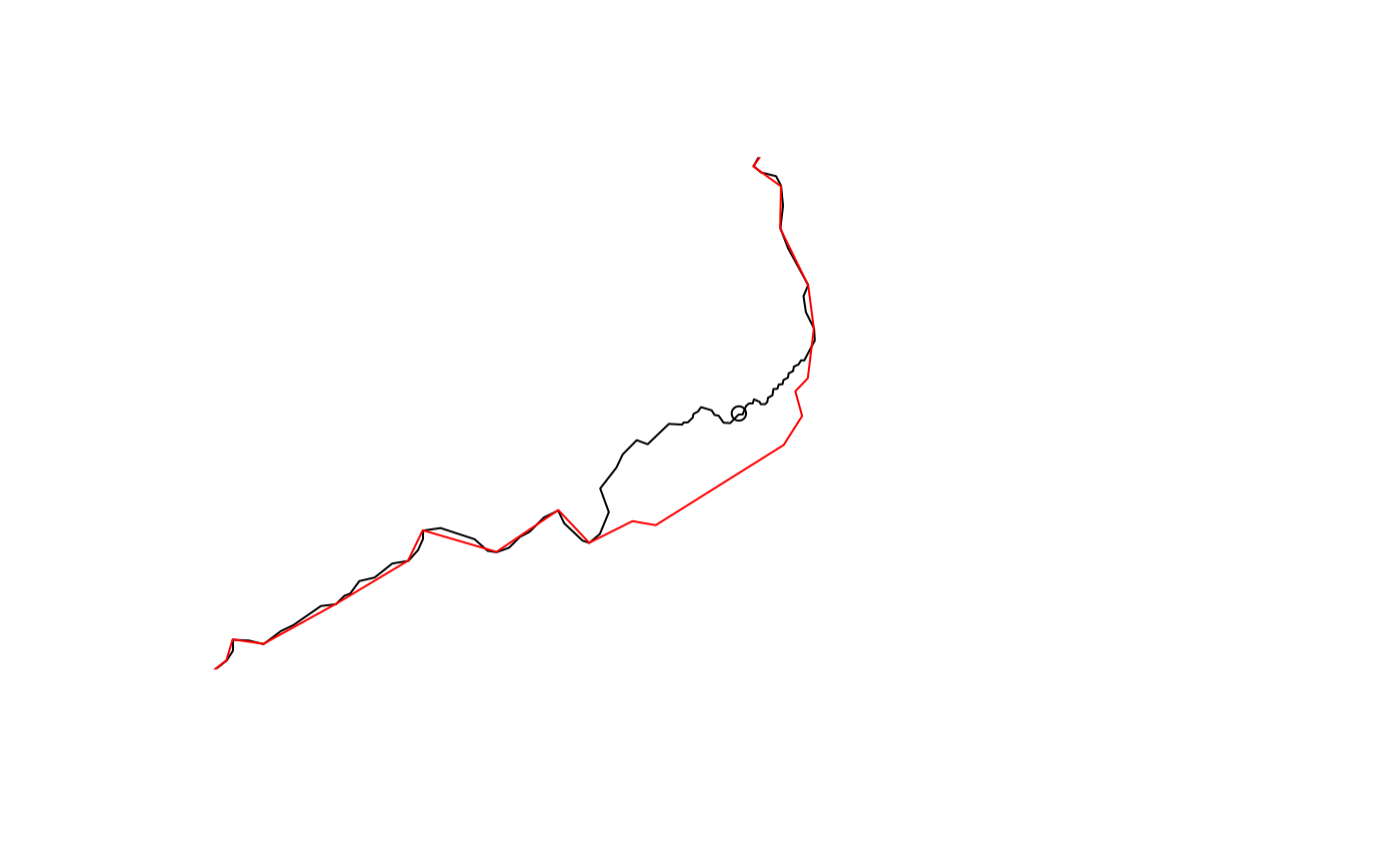
plot(st_geometry(st_buffer(st_transform(site, 5070),
units::set_units(3000, "m"))), border = NA)
plot(st_geometry(st_transform(site, 5070)), add = TRUE)
plot(st_geometry(st_transform(basin2, 5070)), add = TRUE)
plot(st_geometry(st_transform(basin, 5070)), border = "red", add = TRUE)
}
basin
#> Simple feature collection with 1 feature and 0 fields
#> Geometry type: POLYGON
#> Dimension: XY
#> Bounding box: xmin: -89.60465 ymin: 43.03507 xmax: -89.20378 ymax: 43.36607
#> Geodetic CRS: WGS 84
#> # A tibble: 1 × 1
#> geometry
#> * <POLYGON [°]>
#> 1 ((-89.35738 43.11701, -89.35423 43.11546, -89.35437 43.11067, -89.34997 43.10…
basin2 <- get_nldi_basin(nldi_feature = nldi_nwis,
simplify = FALSE, split = TRUE)
#> GET https://api.water.usgs.gov/nldi/linked-data/nwissite/USGS-05428500/basin?simplify=false&splitCatchment=true
if(inherits(basin, "sf") & inherits(basin2, "sf")) {
length(st_coordinates(basin))
length(st_coordinates(basin2))
plot(st_geometry(st_buffer(st_transform(site, 5070),
units::set_units(3000, "m"))), border = NA)
plot(st_geometry(st_transform(site, 5070)), add = TRUE)
plot(st_geometry(st_transform(basin2, 5070)), add = TRUE)
plot(st_geometry(st_transform(basin, 5070)), border = "red", add = TRUE)
}
 # }
# }