Uses a raindrop trace web service to trace the nhdplus digital elevation model to the nearest downslope flowline.
get_raindrop_trace(point, direction = "down")Arguments
Value
sf data.frame containing raindrop trace and requested portion of flowline.
Examples
# \donttest{
point <- sf::st_sfc(sf::st_point(x = c(-89.2158, 42.9561)), crs = 4326)
(trace <- get_raindrop_trace(point))
#> POST https://api.water.usgs.gov/nldi/pygeoapi/processes/nldi-flowtrace/execution
#> {
#> "inputs": [
#> {
#> "id": "lat",
#> "type": "text/plain",
#> "value": "42.9561"
#> },
#> {
#> "id": "lon",
#> "type": "text/plain",
#> "value": "-89.2158"
#> },
#> {
#> "id": "raindroptrace",
#> "type": "text/plain",
#> "value": "true"
#> },
#> {
#> "id": "direction",
#> "type": "text/plain",
#> "value": "down"
#> }
#> ]
#> }
#> Simple feature collection with 2 features and 7 fields
#> Geometry type: LINESTRING
#> Dimension: XY
#> Bounding box: xmin: -89.2158 ymin: 42.94986 xmax: -89.20944 ymax: 42.95681
#> Geodetic CRS: WGS 84
#> # A tibble: 2 × 8
#> id gnis_name comid reachcode raindrop_pathDist measure intersection_point
#> * <chr> <chr> <int> <chr> <dbl> <dbl> <list>
#> 1 down… Yahara R… 1.33e7 07090002… 242. 30.1 <dbl [2]>
#> 2 rain… NA NA NA NA NA <dbl [0]>
#> # ℹ 1 more variable: geometry <LINESTRING [°]>
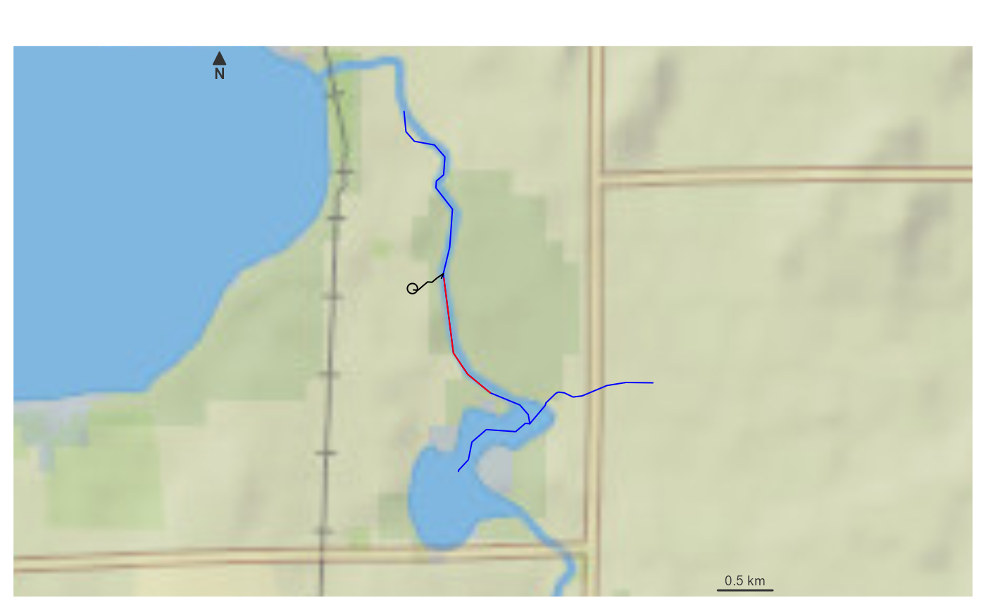
if(inherits(trace, "sf")) {
bbox <- sf::st_bbox(trace) + c(-0.005, -0.005, 0.005, 0.005)
hydrogeofetch::plot_nhdplus(bbox = bbox, cache_data = FALSE)
plot(sf::st_transform(sf::st_sfc(point, crs = 4326), 3857), add = TRUE)
plot(sf::st_transform(sf::st_geometry(trace)[1], 3857), add = TRUE, col = "red")
plot(sf::st_transform(sf::st_geometry(trace)[2], 3857), add = TRUE, col = "black")
}
#> GET https://api.water.usgs.gov/fabric/pygeoapi/collections/nhdflowline_network/items?bbox=-89.2208,42.944865,-89.204442,42.961813&limit=500&offset=0
 # }
# }