Navigate the Network Linked Data Index network.
navigate_nldi(
  nldi_feature,
  mode = "upstreamMain",
  data_source = "flowlines",
  distance_km = 10
)
Arguments
- nldi_feature
list with names `featureSource` and `featureID` where `featureSource` is derived from the "source" column of the response of get_nldi_sources and the `featureID` is a known identifier from the specified `featureSource`.
- mode
character chosen from ("UM", "UT", DM", "DD"). See examples.
- data_source
character chosen from "source" column of the response of get_nldi_sources or empty string for flowline geometry.
- distance_km
numeric distance in km to stop navigating.
Value
sf data.frame with result
Examples
# \donttest{
library(sf)
library(dplyr)
nldi_nwis <- list(featureSource = "nwissite", featureID = "USGS-05428500")
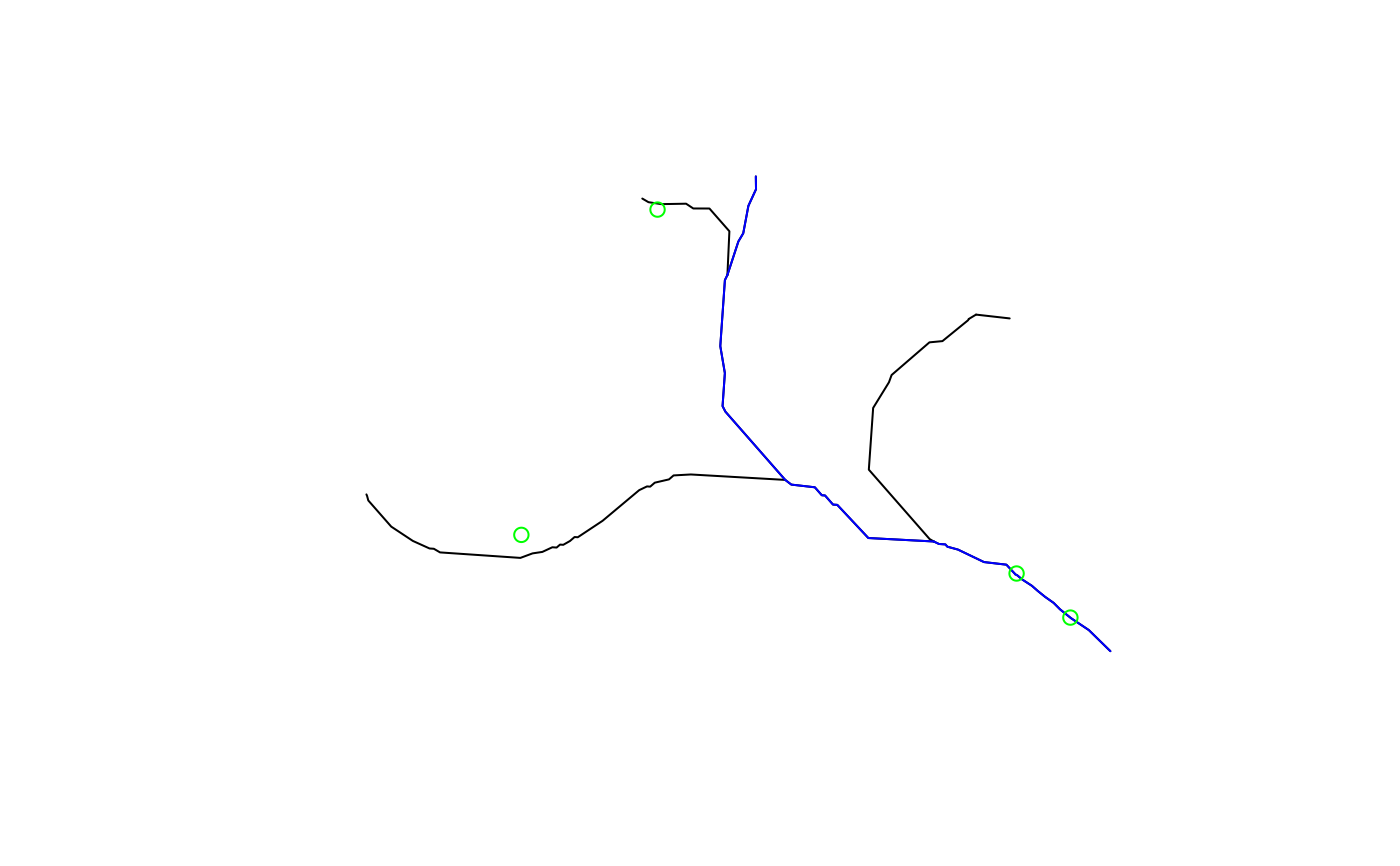
navigate_nldi(nldi_feature = nldi_nwis,
mode = "upstreamTributaries")$UT |>
st_geometry() |>
plot()
navigate_nldi(nldi_feature = nldi_nwis,
mode = "UM")$UM |>
st_geometry() |>
plot(col = "blue", add = TRUE)
nwissite <- navigate_nldi(nldi_feature = nldi_nwis,
mode = "UT",
data_source = "nwissite")$UT_nwissite
st_geometry(nwissite) |>
plot(col = "green", add = TRUE)
 nwissite
#> Simple feature collection with 4 features and 9 fields
#> Geometry type: POINT
#> Dimension: XY
#> Bounding box: xmin: -89.45556 ymin: 43.08944 xmax: -89.36083 ymax: 43.13
#> Geodetic CRS: WGS 84
#> # A tibble: 4 × 10
#> sourceName identifier comid name reachcode measure mainstem X Y
#> <chr> <chr> <int> <chr> <chr> <dbl> <chr> <dbl> <dbl>
#> 1 NWIS Surface W… USGS-0542… 1.33e7 YAHA… 07090002… 42.0 https:/… -89.4 43.1
#> 2 NWIS Surface W… USGS-0542… 1.33e7 LAKE… 07090002… 0 https:/… -89.4 43.1
#> 3 NWIS Surface W… USGS-4306… 1.33e7 LAKE… 07090002… 59.3 https:/… -89.5 43.1
#> 4 NWIS Surface W… USGS-4307… 1.33e7 Warn… 07090002… 100 NA -89.4 43.1
#> # ℹ 1 more variable: geometry <POINT [°]>
# }
nwissite
#> Simple feature collection with 4 features and 9 fields
#> Geometry type: POINT
#> Dimension: XY
#> Bounding box: xmin: -89.45556 ymin: 43.08944 xmax: -89.36083 ymax: 43.13
#> Geodetic CRS: WGS 84
#> # A tibble: 4 × 10
#> sourceName identifier comid name reachcode measure mainstem X Y
#> <chr> <chr> <int> <chr> <chr> <dbl> <chr> <dbl> <dbl>
#> 1 NWIS Surface W… USGS-0542… 1.33e7 YAHA… 07090002… 42.0 https:/… -89.4 43.1
#> 2 NWIS Surface W… USGS-0542… 1.33e7 LAKE… 07090002… 0 https:/… -89.4 43.1
#> 3 NWIS Surface W… USGS-4306… 1.33e7 LAKE… 07090002… 59.3 https:/… -89.5 43.1
#> 4 NWIS Surface W… USGS-4307… 1.33e7 Warn… 07090002… 100 NA -89.4 43.1
#> # ℹ 1 more variable: geometry <POINT [°]>
# }